The Killeaton River, Derriaghy (1)
Introduction
The photograph on this page of The Killeaton River, Derriaghy (1) by Albert Bridge as part of the Geograph project.
The Geograph project started in 2005 with the aim of publishing, organising and preserving representative images for every square kilometre of Great Britain, Ireland and the Isle of Man.

There are currently over 7.5m images from over 14,400 individuals and you can help contribute to the project by visiting https://www.geograph.org.uk
The Killeaton River, Derriaghy (1)
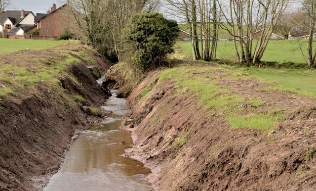
Image: © Albert Bridge Taken: 16 Feb 2013
This majestic watercourse isn’t shown on the 1:50,000 map or the 1:12,000 Greater Belfast street map. It’s a stream which flows into the Lagan somewhere between Derriaghy and Lambeg. This view (upstream), from close to where it goes underground at Queensway, shows some recent work done under what seems to be the “Minor/Urban Watercourse Maintenance Programme A 2012/2013 - Greater Belfast”. The fields on the right have public access and used to be known as the “Killeaton Amenity Area”. The Goole map and the satellite photograph do not quite coincide. Image shows the stream about to pass under Queensway.
Images are licensed for reuse under creativecommons.org/licenses/by-sa/2.0
Image Location
Latitude
54.538168
Longitude
-6.024855