Salisbury Promenade
Introduction
The photograph on this page of Salisbury Promenade by Martin Addison as part of the Geograph project.
The Geograph project started in 2005 with the aim of publishing, organising and preserving representative images for every square kilometre of Great Britain, Ireland and the Isle of Man.

There are currently over 7.5m images from over 14,400 individuals and you can help contribute to the project by visiting https://www.geograph.org.uk
Salisbury Promenade
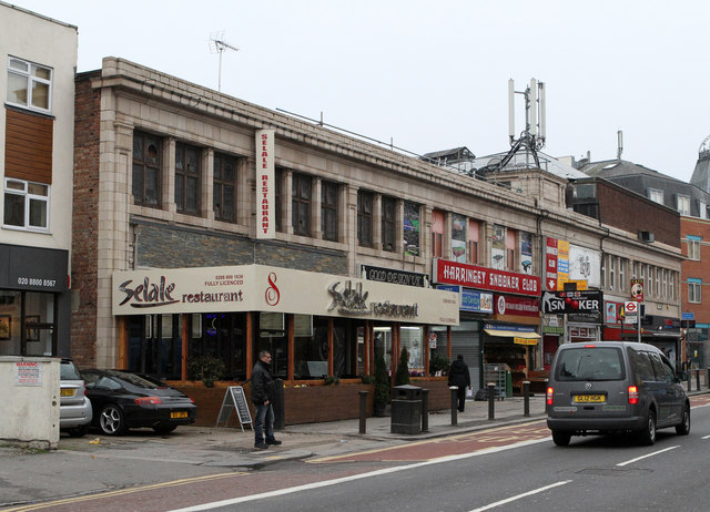
Image: © Martin Addison Taken: 12 Feb 2013
A parade of shops on Green Lanes close to the junction with St Ann's Road. As well as shops and restaurants, the building houses a snooker club displaying variations of the spelling of Harringay - ie Harringey and Haringay.
Images are licensed for reuse under creativecommons.org/licenses/by-sa/2.0
Image Location
Latitude
51.583024
Longitude
-0.099704