Library, Science site, Durham University, 1968
Introduction
The photograph on this page of Library, Science site, Durham University, 1968 by Derek Harper as part of the Geograph project.
The Geograph project started in 2005 with the aim of publishing, organising and preserving representative images for every square kilometre of Great Britain, Ireland and the Isle of Man.

There are currently over 7.5m images from over 14,400 individuals and you can help contribute to the project by visiting https://www.geograph.org.uk
Library, Science site, Durham University, 1968
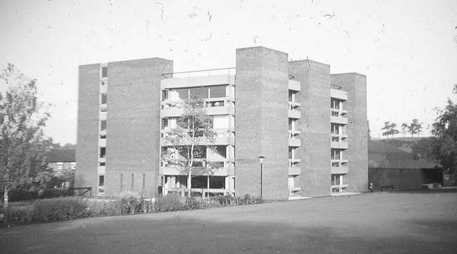
Image: © Derek Harper Taken: Unknown
It would now be impossible to take this view; the square building is now merely the north block of the Bill Bryson Library, which has grown to around four times the size. Something of the building which now occupies most of this lawn can be seen in Image On the left is a house on the other side of Stockton Road. On the right is Whinney Hill.
Images are licensed for reuse under creativecommons.org/licenses/by-sa/2.0
Image Location
Latitude
54.768396
Longitude
-1.573472