The Flookersbrook (closed), Hoole, Chester
Introduction
The photograph on this page of The Flookersbrook (closed), Hoole, Chester by Jeff Buck as part of the Geograph project.
The Geograph project started in 2005 with the aim of publishing, organising and preserving representative images for every square kilometre of Great Britain, Ireland and the Isle of Man.

There are currently over 7.5m images from over 14,400 individuals and you can help contribute to the project by visiting https://www.geograph.org.uk
The Flookersbrook (closed), Hoole, Chester
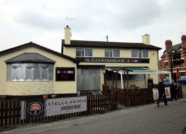
Image: © Jeff Buck Taken: 11 Feb 2013
Previously known as 'The Ermine' this pub was renamed The Flookersbrook in 2004. Rated "one of the ten worst pubs in Chester" by 'The Chester Beer Project' it has now closed along with the next door Honda dealership. The area may be due for redevelopment. chesterwalls http://www.chesterwalls.info/gallery/ermine.html The Chester Beer Project http://chesterbeerproject.blogspot.co.uk/
Images are licensed for reuse under creativecommons.org/licenses/by-sa/2.0
Image Location
Latitude
53.198524
Longitude
-2.881203