Back to backs, Chester-le-Street, 1967
Introduction
The photograph on this page of Back to backs, Chester-le-Street, 1967 by Derek Harper as part of the Geograph project.
The Geograph project started in 2005 with the aim of publishing, organising and preserving representative images for every square kilometre of Great Britain, Ireland and the Isle of Man.

There are currently over 7.5m images from over 14,400 individuals and you can help contribute to the project by visiting https://www.geograph.org.uk
Back to backs, Chester-le-Street, 1967
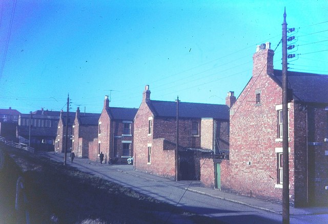
Image: © Derek Harper Taken: Unknown
In the foreground is Wesley Terrace. These terraces, which ran across to Foundry Lane, have since been demolished and the area is now occupied by a car park and a branch of Wilkinson. The building on the left in front of the later housing and beside the station still exists and houses a roofing company. On the left is a bank running up to Station Road.
Images are licensed for reuse under creativecommons.org/licenses/by-sa/2.0
Image Location
Latitude
54.855306
Longitude
-1.57645