War Memorial, Lethanhill
Introduction
The photograph on this page of War Memorial, Lethanhill by Leslie Barrie as part of the Geograph project.
The Geograph project started in 2005 with the aim of publishing, organising and preserving representative images for every square kilometre of Great Britain, Ireland and the Isle of Man.

There are currently over 7.5m images from over 14,400 individuals and you can help contribute to the project by visiting https://www.geograph.org.uk
War Memorial, Lethanhill
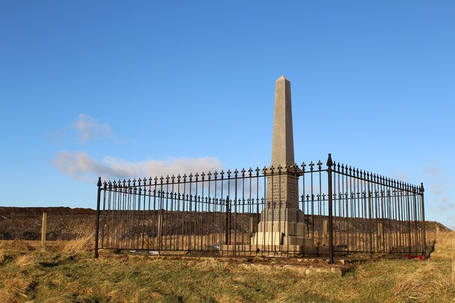
Image: © Leslie Barrie Taken: 6 Feb 2013
Commemorating the fallen of the former mining villages of Lethanhill & Burnfoothill. The larger of the two communities; Lethanhill comprised twelve miners rows and had its own store, school & church. Its population peaked at 1690. The inhabitants were rehoused in nearby Patna after the Second World War with the last resident leaving in 1954. Apart from the still occupied schoolhouse (further down the hill) and the war memorial, the village of Lethanhill has been demolished. Some low walls can still be seen at the edge of the forest plantation. What little may have remained of Burnfoothill has now been completely swept away by Dunstonhill Opencast. The spoil from the opencast can be seen behind the war memorial.
Images are licensed for reuse under creativecommons.org/licenses/by-sa/2.0
Image Location


Leaflet Map data © OpenStreetMap
Latitude
55.362313
Longitude
-4.471032