Cherington church
Introduction
The photograph on this page of Cherington church by Graham Horn as part of the Geograph project.
The Geograph project started in 2005 with the aim of publishing, organising and preserving representative images for every square kilometre of Great Britain, Ireland and the Isle of Man.

There are currently over 7.5m images from over 14,400 individuals and you can help contribute to the project by visiting https://www.geograph.org.uk
Cherington church
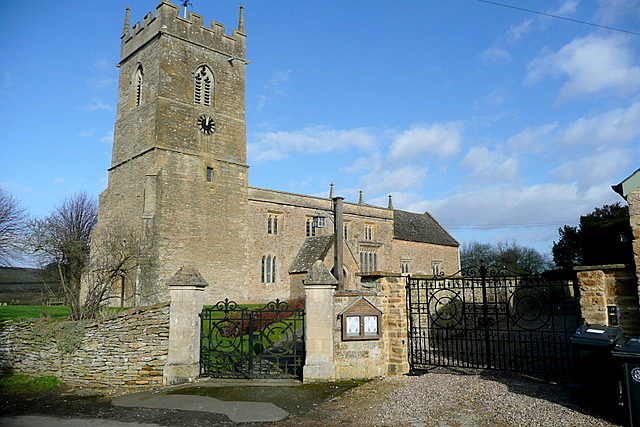
Image: © Graham Horn Taken: 4 Feb 2013
Dedicated to St. John the Baptist and a grade I listed building. It has many 13th century features but has had many alterations in subsequent centuries. http://www.britishlistedbuildings.co.uk/en-305959-church-of-st-john-the-baptist-cherington Shakespeare's Way passes through the churchyard.
Images are licensed for reuse under creativecommons.org/licenses/by-sa/2.0
Image Location


Leaflet Map data © OpenStreetMap
Latitude
52.026783
Longitude
-1.576409