Former London, Midland and Scottish Railway line
Introduction
The photograph on this page of Former London, Midland and Scottish Railway line by David Lally as part of the Geograph project.
The Geograph project started in 2005 with the aim of publishing, organising and preserving representative images for every square kilometre of Great Britain, Ireland and the Isle of Man.

There are currently over 7.5m images from over 14,400 individuals and you can help contribute to the project by visiting https://www.geograph.org.uk
Former London, Midland and Scottish Railway line
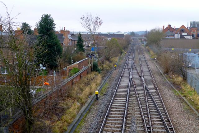
Image: © David Lally Taken: 9 Feb 2013
Passing through Long Eaton. Ahead the Station Road level crossing and footbridge can be seen. Currently used only for freight (especially coal for the nearby Ratcliffe-on-Soar power station) a typical train can be seen here Image The initial preferred route plans for the HS2 high speed link from Birmingham to Leeds intends to utilise this track bed, but will involve the demolition of the adjoining properties on Bonsall Street on the left. The occupiers received notification letters earlier this week.
Images are licensed for reuse under creativecommons.org/licenses/by-sa/2.0
Image Location
Latitude
52.896856
Longitude
-1.26592