East Road
Introduction
The photograph on this page of East Road by Ian Capper as part of the Geograph project.
The Geograph project started in 2005 with the aim of publishing, organising and preserving representative images for every square kilometre of Great Britain, Ireland and the Isle of Man.

There are currently over 7.5m images from over 14,400 individuals and you can help contribute to the project by visiting https://www.geograph.org.uk
East Road
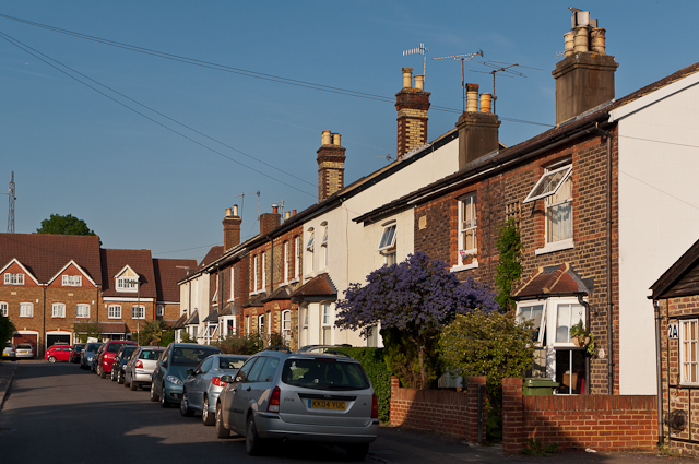
Image: © Ian Capper Taken: 27 May 2012
Victorian cottages (the nearest one has a date plaque of 1883) on a road which until the mid 20th century was called Gasworks Road, reflecting the fact that it led to Reigate gasworks. The site remained in use for gas storage until the 1960s or so, and even after then was the local depot for the nationalised gas board. It was eventually redeveloped in 1999, as seen in the background.
Images are licensed for reuse under creativecommons.org/licenses/by-sa/2.0
Image Location
Latitude
51.241871
Longitude
-0.211164