Chesham from the air
Introduction
The photograph on this page of Chesham from the air by Thomas Nugent as part of the Geograph project.
The Geograph project started in 2005 with the aim of publishing, organising and preserving representative images for every square kilometre of Great Britain, Ireland and the Isle of Man.

There are currently over 7.5m images from over 14,400 individuals and you can help contribute to the project by visiting https://www.geograph.org.uk
Chesham from the air
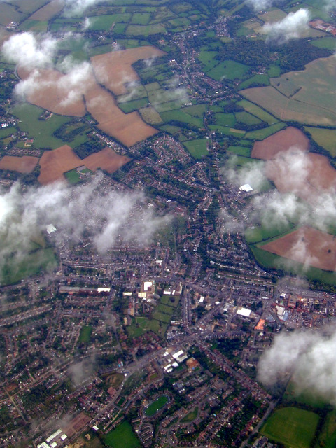
Image: © Thomas Nugent Taken: 9 Oct 2011
The oval shape of Benham Close can be seen near the bottom of the photo, with the cemetery beyond. Botley can be seen in the distance. Viewed from a Heathrow bound flight from Glasgow.
Images are licensed for reuse under creativecommons.org/licenses/by-sa/2.0
Image Location
Latitude
51.713113
Longitude
-0.619125