Trig point of Tuthill Quarry
Introduction
The photograph on this page of Trig point of Tuthill Quarry by Trevor Littlewood as part of the Geograph project.
The Geograph project started in 2005 with the aim of publishing, organising and preserving representative images for every square kilometre of Great Britain, Ireland and the Isle of Man.

There are currently over 7.5m images from over 14,400 individuals and you can help contribute to the project by visiting https://www.geograph.org.uk
Trig point of Tuthill Quarry
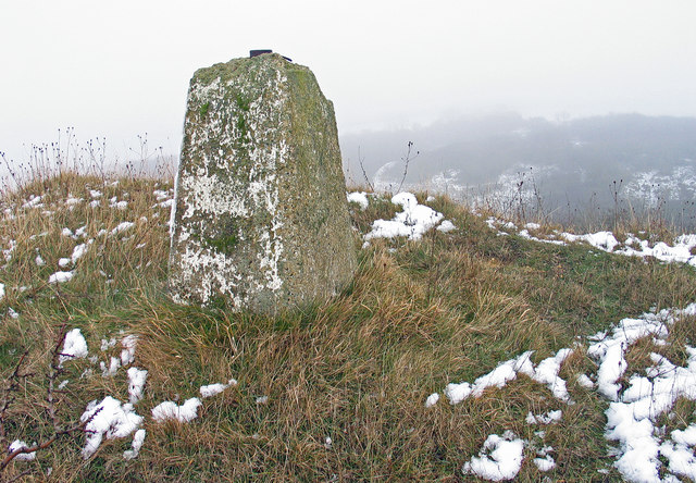
Image: © Trevor Littlewood Taken: 30 Nov 2005
The trig point of Tuthill Quarry is as the name implies close to a quarry, now disused and desolate; the impression of desolation is emphasied by the damage to the pillar and on this visit dreary weather. Unusually the trig point is well away from the local high point - higher ground can be seen in the distance, through the mist. The pillar's poor condition is down not just to deterioration but to vandalism - both the flush bracket and the 'tribrach' from the top have been plundered.
Images are licensed for reuse under creativecommons.org/licenses/by-sa/2.0
Image Location
Latitude
54.7806
Longitude
-1.399209