Roadside plaque, Flex
Introduction
The photograph on this page of Roadside plaque, Flex by Jim Barton as part of the Geograph project.
The Geograph project started in 2005 with the aim of publishing, organising and preserving representative images for every square kilometre of Great Britain, Ireland and the Isle of Man.

There are currently over 7.5m images from over 14,400 individuals and you can help contribute to the project by visiting https://www.geograph.org.uk
Roadside plaque, Flex
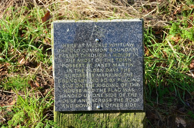
Image: © Jim Barton Taken: 2 Feb 2013
A plaque commemorating the old common boundary of Hawick, which still celebrates with the first of the Border Common Ridings; see the Hawick Common Riding website at http://www.hawickcommonriding.com/ for much more on the history and present day ceremonies.
Images are licensed for reuse under creativecommons.org/licenses/by-sa/2.0
Image Location
Latitude
55.401826
Longitude
-2.788239