Blakenhall Gardens regeneration project, Wolverhampton
Introduction
The photograph on this page of Blakenhall Gardens regeneration project, Wolverhampton by Roger D Kidd as part of the Geograph project.
The Geograph project started in 2005 with the aim of publishing, organising and preserving representative images for every square kilometre of Great Britain, Ireland and the Isle of Man.

There are currently over 7.5m images from over 14,400 individuals and you can help contribute to the project by visiting https://www.geograph.org.uk
Blakenhall Gardens regeneration project, Wolverhampton
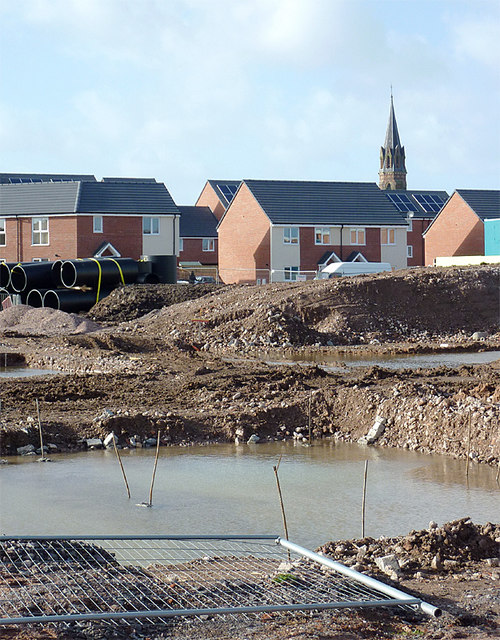
Image: © Roger D Kidd Taken: 30 Jan 2013
This telephoto assisted image from Dudley road shows the view across the site to some of the recently built housing. The spire of St Luke's Church can be seen beyond and to the right of semi-detached house on Plot No 62. The foreground is where there was a shopping precinct formerly, including the very useful Johal Supermarket where fresh "ethnic" vegetables and spices could be bought at very reasonable prices. A new retail area is to be built here soon, including one much larger space suitable for a similarly sized new supermarket. Update - April 2014: the whole project has been completed - looks very smart, including two excellent Asian supermarkets, and some smaller shops.
Images are licensed for reuse under creativecommons.org/licenses/by-sa/2.0
Image Location
Latitude
52.571798
Longitude
-2.126096