Restored Pike House and a modern extension, Dursley
Introduction
The photograph on this page of Restored Pike House and a modern extension, Dursley by Jaggery as part of the Geograph project.
The Geograph project started in 2005 with the aim of publishing, organising and preserving representative images for every square kilometre of Great Britain, Ireland and the Isle of Man.

There are currently over 7.5m images from over 14,400 individuals and you can help contribute to the project by visiting https://www.geograph.org.uk
Restored Pike House and a modern extension, Dursley
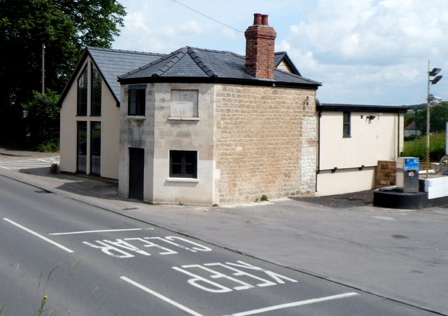
Image: © Jaggery Taken: 21 Jul 2012
The building in front is The Pike House, built in the early 19th century to collect tolls on the turnpike road linking Dursley with the Gloucester to Bristol turnpike road. Here's a view http://www.geograph.org.uk/photo/1810986 from 2010.
Images are licensed for reuse under creativecommons.org/licenses/by-sa/2.0
Image Location
Latitude
51.684173
Longitude
-2.358239