Bucklandwharf
Introduction
The photograph on this page of Bucklandwharf by Rob Farrow as part of the Geograph project.
The Geograph project started in 2005 with the aim of publishing, organising and preserving representative images for every square kilometre of Great Britain, Ireland and the Isle of Man.

There are currently over 7.5m images from over 14,400 individuals and you can help contribute to the project by visiting https://www.geograph.org.uk
Bucklandwharf
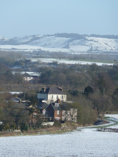
Image: © Rob Farrow Taken: 26 Jan 2013
The settlement of Bucklandwharf is at the eastern end of the village of Aston Clinton. The dyke between the fields and the houses is the Wendover Arm of the Grand Union canal. This section is partly in water but is disconnected from the rest of the canal system so is not navigable, though restoration work is afoot on this arm. The prominent white building was a pub, The New Inn, up to about 20 years ago, but is now home to a company called Homesitters. Pitstone Hill rises in the background.
Images are licensed for reuse under creativecommons.org/licenses/by-sa/2.0
Image Location
Latitude
51.795157
Longitude
-0.701596