
Hillside terrace, Blackawton
Introduction
The photograph on this page of Hillside terrace, Blackawton by Derek Harper as part of the Geograph project.
The Geograph project started in 2005 with the aim of publishing, organising and preserving representative images for every square kilometre of Great Britain, Ireland and the Isle of Man.

There are currently over 7.5m images from over 14,400 individuals and you can help contribute to the project by visiting https://www.geograph.org.uk
Hillside terrace, Blackawton
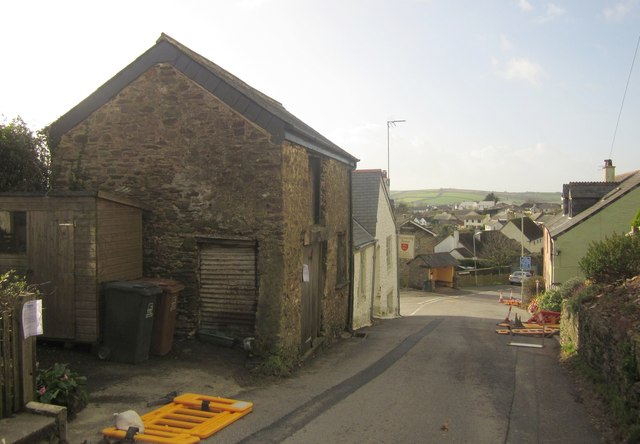
Image: © Derek Harper Taken: 30 Jan 2013
Taken mainly to show a redundant barn, on the left, before it is converted into accommodation; a planning application is attached to the building. It can also just be seen in Image Two doors away down Main Street is the Normandy Arms, straddling a northing gridline - see http://www.geograph.org.uk/search.php?i=39475483 . I think the various roadwork barriers have been flattened by strong wind.
Images are licensed for reuse under creativecommons.org/licenses/by-sa/2.0
Image Location

Latitude
50.346879
Longitude
-3.678646