Approaching Penistone station
Introduction
The photograph on this page of Approaching Penistone station by Stephen Craven as part of the Geograph project.
The Geograph project started in 2005 with the aim of publishing, organising and preserving representative images for every square kilometre of Great Britain, Ireland and the Isle of Man.

There are currently over 7.5m images from over 14,400 individuals and you can help contribute to the project by visiting https://www.geograph.org.uk
Approaching Penistone station
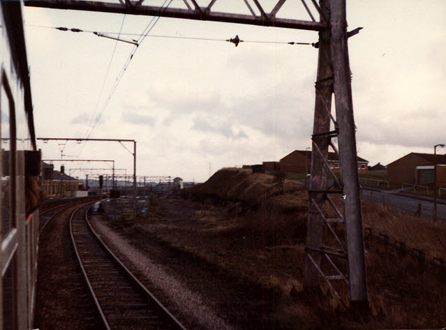
Image: © Stephen Craven Taken: 14 Dec 1980
The former Woodhead railway line as it approaches Penistone from the west, with Eastfield Avenue alongside the railway to the right. The train was a private charter for members of the Oxford University Railway Society, a few months before the line finally closed. I had tried before to locate this photo from my archive, believing it was at the other end of the line around Hadfield, but finally placed it here by locating the houses with the help of aerial photography on the Wheres-the-Path website.
Images are licensed for reuse under creativecommons.org/licenses/by-sa/2.0
Image Location
Latitude
53.525686
Longitude
-1.624816