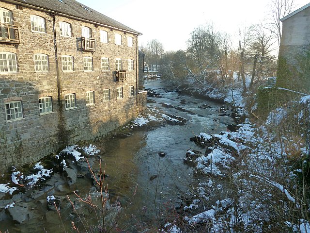
Bridgend Flannel Mill
Introduction
The photograph on this page of Bridgend Flannel Mill by Penny Mayes as part of the Geograph project.
The Geograph project started in 2005 with the aim of publishing, organising and preserving representative images for every square kilometre of Great Britain, Ireland and the Isle of Man.
There are currently over 7.5m images from over 14,400 individuals and you can help contribute to the project by visiting https://www.geograph.org.uk

Image: © Penny Mayes Taken: 24 Jan 2013
Viewed from Short Bridge. Built in 1834 on the site of an 18th century mill, Bridgend Flannel Mill was the last mill in Llanidloes to close. It made use of water power with carding machines below and looms and spinning machines on the upper floors. See photo of the rear of the mill http://www.geograph.org.uk/photo/3313960 where only two floors are apparent. Poor working conditions and periodic depression in the industry, gave rise to Chartist riots in Llanidloes in 1839 which resulted in the imprisonment and in three instances the transportation of those held guilty of fomenting the disturbances. The building, once used as a boys club, has now been converted into apartments.

