Church of St Olave, Hackney
Introduction
The photograph on this page of Church of St Olave, Hackney by David Anstiss as part of the Geograph project.
The Geograph project started in 2005 with the aim of publishing, organising and preserving representative images for every square kilometre of Great Britain, Ireland and the Isle of Man.

There are currently over 7.5m images from over 14,400 individuals and you can help contribute to the project by visiting https://www.geograph.org.uk
Church of St Olave, Hackney
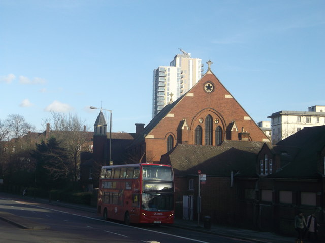
Image: © David Anstiss Taken: 27 Jan 2013
This Grade II listed church is on Seven Sisters Road, near Manor House junction. See http://www.britishlistedbuildings.co.uk/en-426307-church-of-st-olave-greater-london-author for more details about the church. In the background is the Waterside Apartments (near the Manor House reservoirs).
Images are licensed for reuse under creativecommons.org/licenses/by-sa/2.0
Image Location
Latitude
51.571147
Longitude
-0.093706