Ashton bus station
Introduction
The photograph on this page of Ashton bus station by Gerald England as part of the Geograph project.
The Geograph project started in 2005 with the aim of publishing, organising and preserving representative images for every square kilometre of Great Britain, Ireland and the Isle of Man.

There are currently over 7.5m images from over 14,400 individuals and you can help contribute to the project by visiting https://www.geograph.org.uk
Ashton bus station
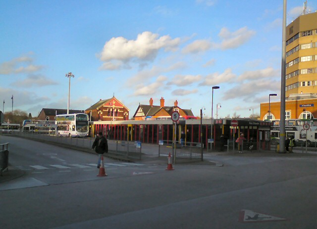
Image: © Gerald England Taken: 27 Jan 2013
Ashton under Lyne bus station on a quiet Sunday afternoon. The building on the right is the council offices for Tameside Metropolitan Borough Council. In the background are the Prince of Orange public house and the Independent Methodist Church.
Images are licensed for reuse under creativecommons.org/licenses/by-sa/2.0
Image Location


Leaflet Map data © OpenStreetMap
Latitude
53.490281
Longitude
-2.095968