Larkin Trail 16/25 - Sharp Street
Introduction
The photograph on this page of Larkin Trail 16/25 - Sharp Street by Peter Church as part of the Geograph project.
The Geograph project started in 2005 with the aim of publishing, organising and preserving representative images for every square kilometre of Great Britain, Ireland and the Isle of Man.

There are currently over 7.5m images from over 14,400 individuals and you can help contribute to the project by visiting https://www.geograph.org.uk
Larkin Trail 16/25 - Sharp Street
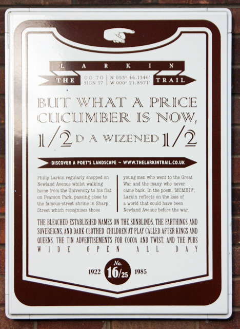
Image: © Peter Church Taken: 27 Jan 2013
See http://www.thelarkintrail.co.uk/beyond-the-city-centre.php?item=trialItem_name_16#trialItem_name_16 for information on this plaque, and http://www.thelarkintrail.co.uk/ for the trail overall. See Image for an image of the location.
Images are licensed for reuse under creativecommons.org/licenses/by-sa/2.0
Image Location


Leaflet Map data © OpenStreetMap
Latitude
53.76321
Longitude
-0.35904