Southburn Dene railway viaduct, 1968
Introduction
The photograph on this page of Southburn Dene railway viaduct, 1968 by Derek Harper as part of the Geograph project.
The Geograph project started in 2005 with the aim of publishing, organising and preserving representative images for every square kilometre of Great Britain, Ireland and the Isle of Man.

There are currently over 7.5m images from over 14,400 individuals and you can help contribute to the project by visiting https://www.geograph.org.uk
Southburn Dene railway viaduct, 1968
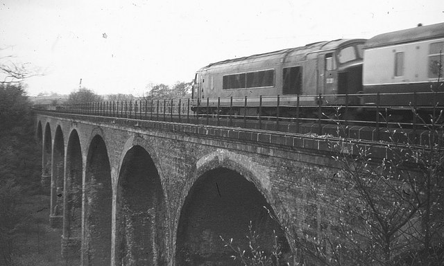
Image: © Derek Harper Taken: 1 May 1968
A service crosses the viaduct south of Chester-le-Street, spanning Southburn Dene just north of the railway bridge shown in http://www.geograph.org.uk/search.php?i=39378269 . That looks like a Sulzer type 4 locomotive. The 8-arched viaduct dates from 1868 http://www.imagesofengland.org.uk/Details/Default.aspx?id=109372&mode=adv ; the stone plinths can be seen below. The dene is more wooded these days. The South Burn joins the Wear less than a kilometre away, to the left.
Images are licensed for reuse under creativecommons.org/licenses/by-sa/2.0
Image Location
Latitude
54.842287
Longitude
-1.579545