Chalk cliffs at Garronpoint
Introduction
The photograph on this page of Chalk cliffs at Garronpoint by Robert Ashby as part of the Geograph project.
The Geograph project started in 2005 with the aim of publishing, organising and preserving representative images for every square kilometre of Great Britain, Ireland and the Isle of Man.

There are currently over 7.5m images from over 14,400 individuals and you can help contribute to the project by visiting https://www.geograph.org.uk
Chalk cliffs at Garronpoint
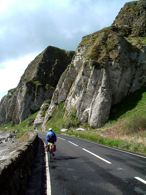
Image: © Robert Ashby Taken: 3 May 2004
The Antrim Coast Road was constructed in 1842 and is one of the most spectacular roads in Ireland, hugging the coast for about 35 miles from Larne to Cushendall. Because of frequent rock falls along this stretch the road was closed in 2010 for eight weeks while safety nets were fitted to prevent rocks falling on to the road. The main A2 continues from just before Cushendun to Ballycastle on an inland stretch via Ballypatrick but it is possible to continue via the coastal route on the steep, narrow and winding Torr Rd to Torr Head, considered a challenge by 4x4 drivers and cyclists though not recommended if towing a caravan.
Images are licensed for reuse under creativecommons.org/licenses/by-sa/2.0
Image Location
Latitude
55.058746
Longitude
-5.992563