Farmland near Atherstone
Introduction
The photograph on this page of Farmland near Atherstone by Graham Horn as part of the Geograph project.
The Geograph project started in 2005 with the aim of publishing, organising and preserving representative images for every square kilometre of Great Britain, Ireland and the Isle of Man.

There are currently over 7.5m images from over 14,400 individuals and you can help contribute to the project by visiting https://www.geograph.org.uk
Farmland near Atherstone
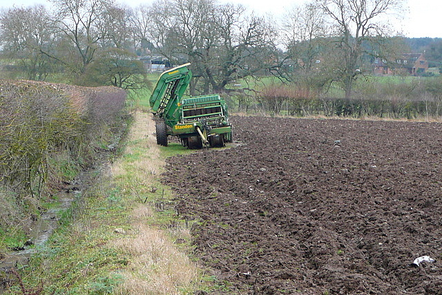
Image: © Graham Horn Taken: 12 Jan 2013
The rich arable soil is evident here. This piece of machinery a Standen potato harvester. The folded arrangement on the side is an elevator for loading trailers as the unit moves down the field. It is tractor towed. Thanks to Michael Trolove http://www.geograph.org.uk/profile/19979 for identification and explanation. When I first saw it, I thought it might be like a Swiss Army Knife and do lots of other things as well. It has been parked here for a while; notice how the field has been ploughed around it.
Images are licensed for reuse under creativecommons.org/licenses/by-sa/2.0
Image Location


Leaflet Map data © OpenStreetMap
Latitude
52.160504
Longitude
-1.704662