Nottingham, NG3 - St Ann's Area.
Introduction
The photograph on this page of Nottingham, NG3 - St Ann's Area. by David Hallam-Jones as part of the Geograph project.
The Geograph project started in 2005 with the aim of publishing, organising and preserving representative images for every square kilometre of Great Britain, Ireland and the Isle of Man.

There are currently over 7.5m images from over 14,400 individuals and you can help contribute to the project by visiting https://www.geograph.org.uk
Nottingham, NG3 - St Ann's Area.
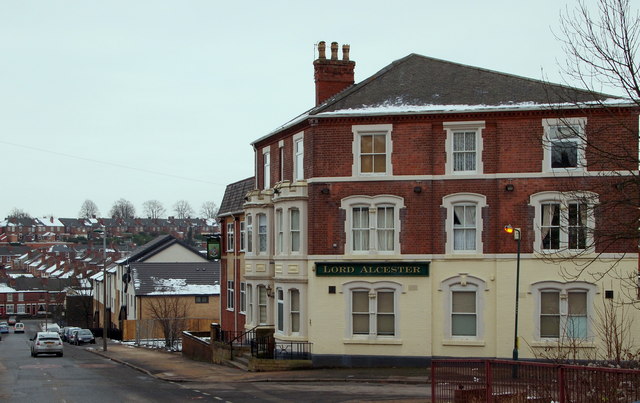
Image: © David Hallam-Jones Taken: 24 Jan 2013
The former Lord Alcester pub, near the summit of St Mathias' Road, that was built in the 1950s and that has been converted into nine self-contained flats (2012). The premises, that are still called by their original name, have been extended on their Carlton Road side. The pub took its name from Admiral Frederick Beauchamp Paget Seymour, the 1st Lord Alcester (1821-95), the British naval Commander-in-Chief of the Channel Fleet between 1874-77 and of the Mediterranean Fleet between 1880-83.
Images are licensed for reuse under creativecommons.org/licenses/by-sa/2.0
Image Location
Latitude
52.958783
Longitude
-1.131041