Railway Viaduct at Chester-le-Street, 1967
Introduction
The photograph on this page of Railway Viaduct at Chester-le-Street, 1967 by Derek Harper as part of the Geograph project.
The Geograph project started in 2005 with the aim of publishing, organising and preserving representative images for every square kilometre of Great Britain, Ireland and the Isle of Man.

There are currently over 7.5m images from over 14,400 individuals and you can help contribute to the project by visiting https://www.geograph.org.uk
Railway Viaduct at Chester-le-Street, 1967
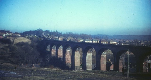
Image: © Derek Harper Taken: Unknown
As http://list.english-heritage.org.uk/resultsingle.aspx?uid=1159006&searchtype=mapsearch states, "an important townscape feature", 230 metres long with 11 arches. See also http://www.geograph.org.uk/search.php?i=39343503 . The buildings on the Chester Burn valley floor below have vanished, but the estates on the hillsides are almost the same.
Images are licensed for reuse under creativecommons.org/licenses/by-sa/2.0
Image Location
Latitude
54.858461
Longitude
-1.579221