South Crescent, Hartlepool, 1967
Introduction
The photograph on this page of South Crescent, Hartlepool, 1967 by Derek Harper as part of the Geograph project.
The Geograph project started in 2005 with the aim of publishing, organising and preserving representative images for every square kilometre of Great Britain, Ireland and the Isle of Man.

There are currently over 7.5m images from over 14,400 individuals and you can help contribute to the project by visiting https://www.geograph.org.uk
South Crescent, Hartlepool, 1967
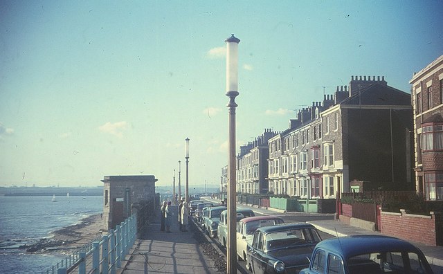
Image: © Derek Harper Taken: Unknown
With the junction with Baptist Street on the right. The terrace beyond it is Albion Terrace, a listed row of seven houses http://list.english-heritage.org.uk/resultsingle.aspx?uid=1263430&searchtype=mapsearch . Not sure what the structure on the left is; it's no longer there.
Images are licensed for reuse under creativecommons.org/licenses/by-sa/2.0
Image Location
Latitude
54.693854
Longitude
-1.180337