Former Croydon aerodrome, 1967
Introduction
The photograph on this page of Former Croydon aerodrome, 1967 by Derek Harper as part of the Geograph project.
The Geograph project started in 2005 with the aim of publishing, organising and preserving representative images for every square kilometre of Great Britain, Ireland and the Isle of Man.

There are currently over 7.5m images from over 14,400 individuals and you can help contribute to the project by visiting https://www.geograph.org.uk
Former Croydon aerodrome, 1967
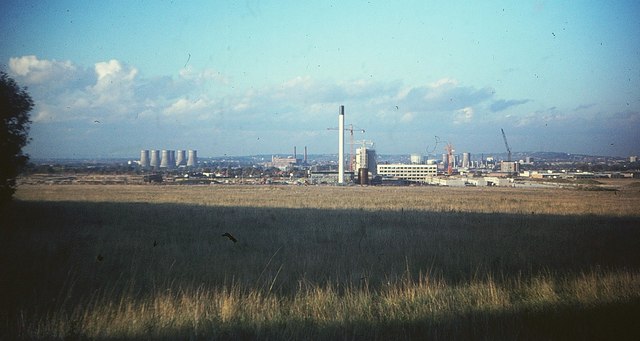
Image: © Derek Harper Taken: Unknown
The view looks across the chalk grassland of the aerodrome, which closed in 1959. There is now woodland and allotments in the foreground area. Showing the progress on the Roundshaw estate since Image was taken, with a tall chimney on the communal boiler house of a centralised heating system. The first tenants had moved in to the estate the previous month. To its left is the Croydon B power station and some cooling towers; central Croydon is to the right.
Images are licensed for reuse under creativecommons.org/licenses/by-sa/2.0
Image Location
Latitude
51.349349
Longitude
-0.130354