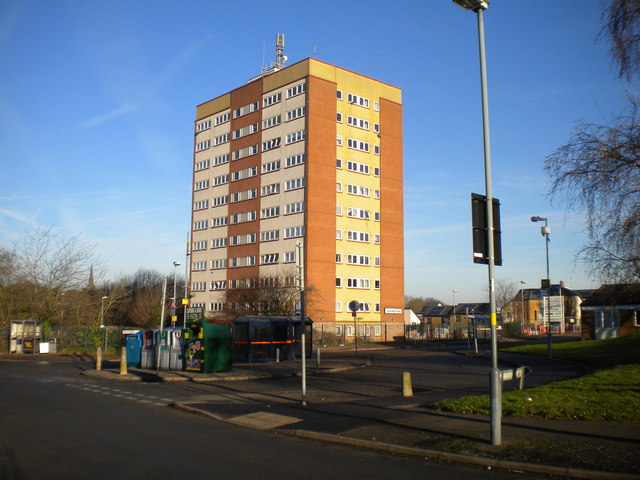
Sisefield Road turning circle, Pool Farm
Introduction
The photograph on this page of Sisefield Road turning circle, Pool Farm by Richard Vince as part of the Geograph project.
The Geograph project started in 2005 with the aim of publishing, organising and preserving representative images for every square kilometre of Great Britain, Ireland and the Isle of Man.
There are currently over 7.5m images from over 14,400 individuals and you can help contribute to the project by visiting https://www.geograph.org.uk

Image: © Richard Vince Taken: 8 Dec 2012
The bus turning circle at the west end of Hillmeads Road where it meets Sisefield Road (foreground) was once the terminus of route 35 from Birmingham city centre, but has been largely unused since that route was extended to Hawkesley. It is loomed over by Speedwell House, the sole high rise block in this area; every post war council estate in Birmingham always seemed to have at least one tower block.

