Southall: Allenby Road Water Tower
Introduction
The photograph on this page of Southall: Allenby Road Water Tower by Nigel Cox as part of the Geograph project.
The Geograph project started in 2005 with the aim of publishing, organising and preserving representative images for every square kilometre of Great Britain, Ireland and the Isle of Man.

There are currently over 7.5m images from over 14,400 individuals and you can help contribute to the project by visiting https://www.geograph.org.uk
Southall: Allenby Road Water Tower
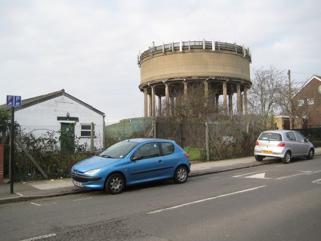
Image: © Nigel Cox Taken: 13 Jan 2013
The water tower is contemporary with the inter-war housing estates around it. Before the houses were built Allenby Road was known as Muddy Lane. As ever with water towers these days this one is festooned with the usual array of communications aerials. The hut on the left is a Scout Hall.
Images are licensed for reuse under creativecommons.org/licenses/by-sa/2.0
Image Location
Latitude
51.528074
Longitude
-0.368123