Looking up Gower Road
Introduction
The photograph on this page of Looking up Gower Road by Gerald England as part of the Geograph project.
The Geograph project started in 2005 with the aim of publishing, organising and preserving representative images for every square kilometre of Great Britain, Ireland and the Isle of Man.

There are currently over 7.5m images from over 14,400 individuals and you can help contribute to the project by visiting https://www.geograph.org.uk
Looking up Gower Road
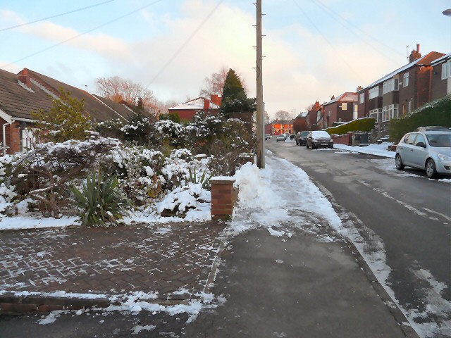
Image: © Gerald England Taken: 22 Jan 2013
The view up Gower Road towards Dowson Road. A row of modern bunaglows are on the left. On the right are semi-detached houses. Higher up terraced houses can be found. After recent snow, whilst the road itself is fairly clear, except where householders have done their own clearing, the pavements are treacherously icy.
Images are licensed for reuse under creativecommons.org/licenses/by-sa/2.0
Image Location
Latitude
53.444633
Longitude
-2.077949