Prefabricated housing, Calverton
Introduction
The photograph on this page of Prefabricated housing, Calverton by Richard Vince as part of the Geograph project.
The Geograph project started in 2005 with the aim of publishing, organising and preserving representative images for every square kilometre of Great Britain, Ireland and the Isle of Man.

There are currently over 7.5m images from over 14,400 individuals and you can help contribute to the project by visiting https://www.geograph.org.uk
Prefabricated housing, Calverton
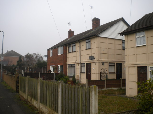
Image: © Richard Vince Taken: 24 Nov 2012
When Calverton expanded westwards in the 1950s to provide housing for miners (employed at the colliery which opened in 1952), some semi detached prefabs were erected as part of the expansion. While some are still substantially as built, at least one of every pair I saw has been modernised with a new outer wall; this odd looking pair is thus typical of this part of the village. These houses front onto a small green off Labray Road.
Images are licensed for reuse under creativecommons.org/licenses/by-sa/2.0
Image Location
Latitude
53.042427
Longitude
-1.088641