Sandridge Road Wastes
Introduction
The photograph on this page of Sandridge Road Wastes by Ian Capper as part of the Geograph project.
The Geograph project started in 2005 with the aim of publishing, organising and preserving representative images for every square kilometre of Great Britain, Ireland and the Isle of Man.

There are currently over 7.5m images from over 14,400 individuals and you can help contribute to the project by visiting https://www.geograph.org.uk
Sandridge Road Wastes
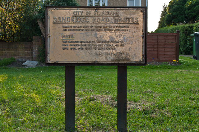
Image: © Ian Capper Taken: 25 Jul 2012
Sign prohibiting parking on the Sandridge Road Wastes, made by byelaws in 1955. The Sandridge Road Wastes are strips of common land either side of the road originally used for resting and grazing animals prior to market, with the right to use them free of charge having been granted following the Peasants' Revolt in 1381. See Image for a picture of the road showing the Wastes. The Wastes have been managed by St Albans City Council since 1915.
Images are licensed for reuse under creativecommons.org/licenses/by-sa/2.0
Image Location
Latitude
51.76535
Longitude
-0.323525