Banc y Llyn
Introduction
The photograph on this page of Banc y Llyn by Rude Health as part of the Geograph project.
The Geograph project started in 2005 with the aim of publishing, organising and preserving representative images for every square kilometre of Great Britain, Ireland and the Isle of Man.

There are currently over 7.5m images from over 14,400 individuals and you can help contribute to the project by visiting https://www.geograph.org.uk
Banc y Llyn
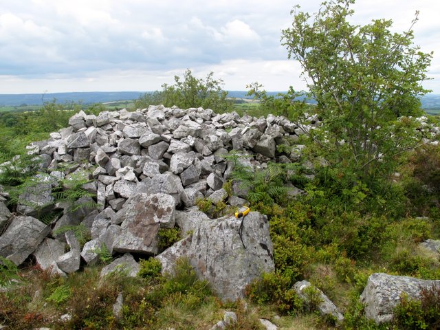
Image: © Rude Health Taken: 1 Jul 2011
From B road to SW via overgrown path on sunny afternoon. Large ancient cairn and nearby rocks. Name: Banc y Llyn Hill number: 5267 Height: 280m / 919ft Area: 32B: Carmarthen to Vale of Neath Class: Hu Grid ref: SN 57967 15790 Summit feature: large cairn Drop: 129m Col: 151m SN559132
Images are licensed for reuse under creativecommons.org/licenses/by-sa/2.0
Image Location


Leaflet Map data © OpenStreetMap
Latitude
51.822626
Longitude
-4.062342