Former toll house, Merthyr Tydfil
Introduction
The photograph on this page of Former toll house, Merthyr Tydfil by Robin Drayton as part of the Geograph project.
The Geograph project started in 2005 with the aim of publishing, organising and preserving representative images for every square kilometre of Great Britain, Ireland and the Isle of Man.

There are currently over 7.5m images from over 14,400 individuals and you can help contribute to the project by visiting https://www.geograph.org.uk
Former toll house, Merthyr Tydfil
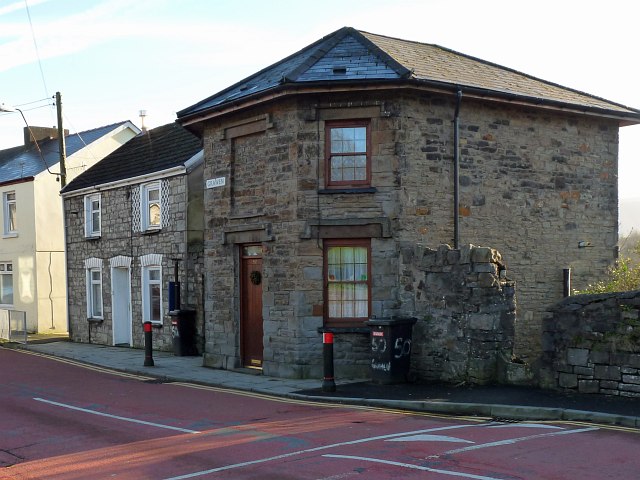
Image: © Robin Drayton Taken: 9 Jan 2013
Situated on the Brecon Road. Dating from 1842, it is also known as the Round House.
Images are licensed for reuse under creativecommons.org/licenses/by-sa/2.0
Image Location
Latitude
51.752763
Longitude
-3.388219