Lossie and Linkwood
Introduction
The photograph on this page of Lossie and Linkwood by Anne Burgess as part of the Geograph project.
The Geograph project started in 2005 with the aim of publishing, organising and preserving representative images for every square kilometre of Great Britain, Ireland and the Isle of Man.

There are currently over 7.5m images from over 14,400 individuals and you can help contribute to the project by visiting https://www.geograph.org.uk
Lossie and Linkwood
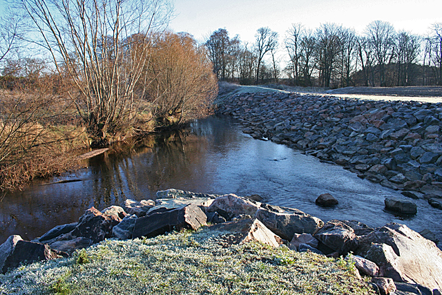
Image: © Anne Burgess Taken: 15 Jan 2013
On the left is the River Lossie, and the Linkwood Burn, in its new channel, joins from the right. The banks of the river have been strengthened with large boulders to reduce the effects of erosion.
Images are licensed for reuse under creativecommons.org/licenses/by-sa/2.0
Image Location
Latitude
57.643038
Longitude
-3.264058