Site of Cambus station, 1991
Introduction
The photograph on this page of Site of Cambus station, 1991 by Ben Brooksbank as part of the Geograph project.
The Geograph project started in 2005 with the aim of publishing, organising and preserving representative images for every square kilometre of Great Britain, Ireland and the Isle of Man.

There are currently over 7.5m images from over 14,400 individuals and you can help contribute to the project by visiting https://www.geograph.org.uk
Site of Cambus station, 1991
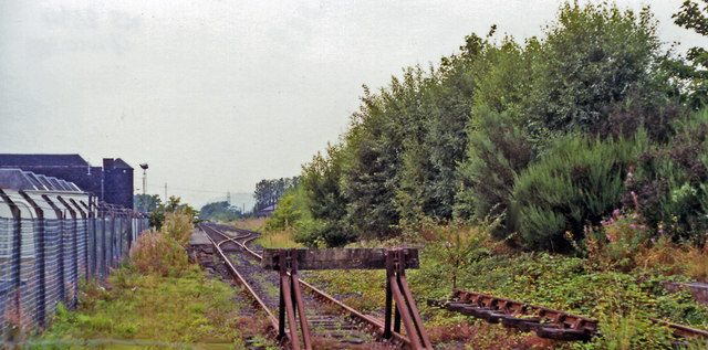
Image: © Ben Brooksbank Taken: 5 Sep 1991
View westward, towards Stirling, and Alva branch to right: ex-NBR Stirling - Alloa etc., junction for Alva. At this time in 1991 the line was moribund, the station having been closed from 7/10/68, but the line has since been reopened for passengers between Stirling and Alloa since 15/5/08. [?] (Cf. Image]).
Images are licensed for reuse under creativecommons.org/licenses/by-sa/2.0
Image Location
Latitude
56.126221
Longitude
-3.842897