Castle Yard
Introduction
The photograph on this page of Castle Yard by Gerald England as part of the Geograph project.
The Geograph project started in 2005 with the aim of publishing, organising and preserving representative images for every square kilometre of Great Britain, Ireland and the Isle of Man.

There are currently over 7.5m images from over 14,400 individuals and you can help contribute to the project by visiting https://www.geograph.org.uk
Castle Yard
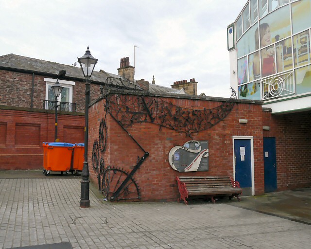
Image: © Gerald England Taken: 7 Jan 2013
Castle Yard was the "Motte" of a Norman castle and the castle "Bailey" the area which is now the Market Place. The castle walls were demolished in the 1770s when Castle Mill, the first water powered cotton mill in Stockport was constructed. The Mill was demolished in 1841 and from 1853 the area was used as a cattle market. Today Castle Yard forms a link between the outside market and the Courts shopping development created from the conversion of the adjacent former Magistrates Courts building. 21st century excavations revealed the wheelpit. In 2005 artist Mike Woods created a piece of public art designed on the water whee1 which once powered Castle Mill. It consists of a banner that depicts workers caught up in a "mad whirl of machines and knotted tangled threads coupled with frenzied activity as they strive to adapt new technologies and the need to keep pace with the contantly changing new industrial age". "The Banner of the Industrial Revelution" Image is wrapped around the outside of the ladies public convenience.
Images are licensed for reuse under creativecommons.org/licenses/by-sa/2.0
Image Location
Latitude
53.411926
Longitude
-2.157321