Cliffe High Street
Introduction
The photograph on this page of Cliffe High Street by Simon Carey as part of the Geograph project.
The Geograph project started in 2005 with the aim of publishing, organising and preserving representative images for every square kilometre of Great Britain, Ireland and the Isle of Man.

There are currently over 7.5m images from over 14,400 individuals and you can help contribute to the project by visiting https://www.geograph.org.uk
Cliffe High Street
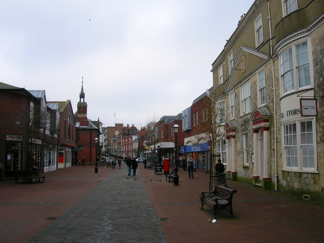
Image: © Simon Carey Taken: 4 Feb 2007
Pedestrianised in 1990 having once been the main A27 trunk road through the town until the building of Phoenix Causeway in the early 1970s. The view until 1968 would also have included an iron bridge that carried the Lewes to Uckfield line over the street, the position now occupied by WH Smiths on the right and the new buildings to the left.
Images are licensed for reuse under creativecommons.org/licenses/by-sa/2.0
Image Location


Leaflet Map data © OpenStreetMap
Latitude
50.874086
Longitude
0.014308