The "Obel", Belfast (9)
Introduction
The photograph on this page of The "Obel", Belfast (9) by Albert Bridge as part of the Geograph project.
The Geograph project started in 2005 with the aim of publishing, organising and preserving representative images for every square kilometre of Great Britain, Ireland and the Isle of Man.

There are currently over 7.5m images from over 14,400 individuals and you can help contribute to the project by visiting https://www.geograph.org.uk
The "Obel", Belfast (9)
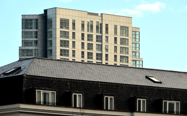
Image: © Albert Bridge Taken: 11 Jan 2013
See Image Two symbols of the property boom before the recession. The “Obel” tower rising above the St Anne’s Square development Image seen from the grounds of the Art College.
Images are licensed for reuse under creativecommons.org/licenses/by-sa/2.0
Image Location
Latitude
54.60267
Longitude
-5.922373