Botanical Gardens, LE2
Introduction
The photograph on this page of Botanical Gardens, LE2 by David Hallam-Jones as part of the Geograph project.
The Geograph project started in 2005 with the aim of publishing, organising and preserving representative images for every square kilometre of Great Britain, Ireland and the Isle of Man.

There are currently over 7.5m images from over 14,400 individuals and you can help contribute to the project by visiting https://www.geograph.org.uk
Botanical Gardens, LE2
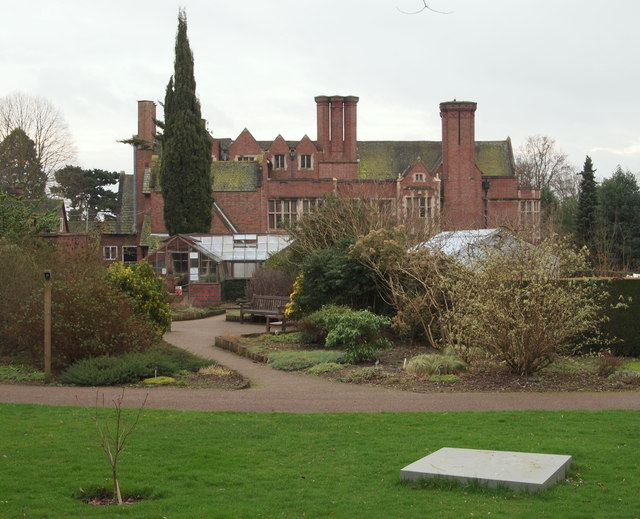
Image: © David Hallam-Jones Taken: 7 Jan 2013
A side elevation of Hastings Hall plus greenhouses containing the alpine collection. Also, a temporarily unused sculpture base is visible in the foreground. The original Leicester, Leics & Rutland College botanical garden complex (later to become The University of Leicester botanical garden) existed near Victoria Park between 1921-25 and remained there until 1947 when the demand for space there made a move elsewhere necessary. Four houses (that were all designed by Stockdale Harrison), each with their respective gardens, were gradually purchased - Hastings in 1902, Beaumont in 1904, The Knoll in 1908 and Southmeade in 1928 - in order to provide additional Halls and to facilitate the development of a new Botanical Garden complex.
Images are licensed for reuse under creativecommons.org/licenses/by-sa/2.0
Image Location
Latitude
52.606985
Longitude
-1.091355