Looking west from Sandilands tramstop, Croydon
Introduction
The photograph on this page of Looking west from Sandilands tramstop, Croydon by Philip Talmage as part of the Geograph project.
The Geograph project started in 2005 with the aim of publishing, organising and preserving representative images for every square kilometre of Great Britain, Ireland and the Isle of Man.

There are currently over 7.5m images from over 14,400 individuals and you can help contribute to the project by visiting https://www.geograph.org.uk
Looking west from Sandilands tramstop, Croydon
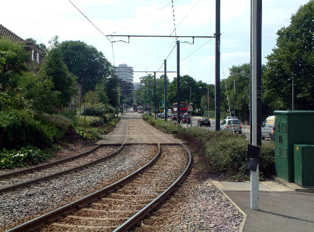
Image: © Philip Talmage Taken: 2 Aug 2005
The Tramlink stop at Sandilands is where the branch from New Addington meets the line from Beckenham and Elmers End, both occupying part of the former railway line that terminated at Selsdon. The picture shows new line, towards Croydon. A tram is approaching, and the "threepenny bit building", as it is known locally (actually the NLA Tower) is in the background.
Images are licensed for reuse under creativecommons.org/licenses/by-sa/2.0
Image Location
Latitude
51.375296
Longitude
-0.077713