Cwm, Llandudoch/St Dogmaels
Introduction
The photograph on this page of Cwm, Llandudoch/St Dogmaels by Natasha Ceridwen de Chroustchoff as part of the Geograph project.
The Geograph project started in 2005 with the aim of publishing, organising and preserving representative images for every square kilometre of Great Britain, Ireland and the Isle of Man.

There are currently over 7.5m images from over 14,400 individuals and you can help contribute to the project by visiting https://www.geograph.org.uk
Cwm, Llandudoch/St Dogmaels
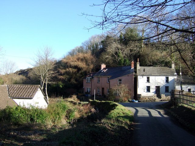
Image: © Natasha Ceridwen de Chroustchoff Taken: 3 Feb 2007
Houses perch on the steep sides of this glacial ravine, Cwm Degwel, that runs down into the village. This land was virtually unsettled in the 1840s, but by 1891 formed a significant part of the village. A few of these cottages were probably 'tai unnos' (one night houses) characterised by the single dwelling standing in an enclosed garden. The ruins behind the bank on the left suggest there may have been a mill here.
Images are licensed for reuse under creativecommons.org/licenses/by-sa/2.0
Image Location


Leaflet Map data © OpenStreetMap
Latitude
52.073539
Longitude
-4.685487