Former air raid shelter, Bangor
Introduction
The photograph on this page of Former air raid shelter, Bangor by Albert Bridge as part of the Geograph project.
The Geograph project started in 2005 with the aim of publishing, organising and preserving representative images for every square kilometre of Great Britain, Ireland and the Isle of Man.

There are currently over 7.5m images from over 14,400 individuals and you can help contribute to the project by visiting https://www.geograph.org.uk
Former air raid shelter, Bangor
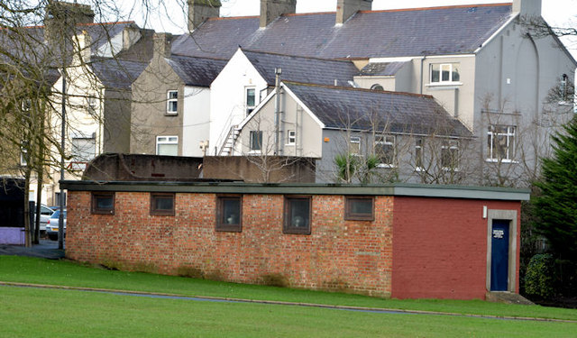
Image: © Albert Bridge Taken: 8 Jan 2013
A former public air raid shelter, at the Park Drive end of Ward Park, described in http://ww2ni.webs.com/countydownpart4.htm and similar to the one in Lisburn Image The Luftwaffe bombed Bangor twice – on 13 September 1940 and 15/16 April 1941. Previously seen in Image (May 2010).
Images are licensed for reuse under creativecommons.org/licenses/by-sa/2.0
Image Location
Latitude
54.660389
Longitude
-5.663072