Crossroads at Ripple
Introduction
The photograph on this page of Crossroads at Ripple by John Baker as part of the Geograph project.
The Geograph project started in 2005 with the aim of publishing, organising and preserving representative images for every square kilometre of Great Britain, Ireland and the Isle of Man.

There are currently over 7.5m images from over 14,400 individuals and you can help contribute to the project by visiting https://www.geograph.org.uk
Crossroads at Ripple
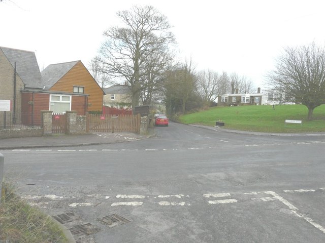
Image: © John Baker Taken: 30 Dec 2012
Seen from Pommeus Lane looking across the road to Mongeham Road. Taking a left turn takes one into Sutton Lane, while to the right is Chapel Lane. The row of houses at the top of the green verge are known as Maytree Cottages, whose design, in my opinion, leaves much to be desired! On the corner of Mongeham Road is Ripplevale School, an independent special school catering for the needs of boys between 7-16 years, who are statemented as having ESBD, ASD and/or associated syndromes http://www.ripplevaleschool.co.uk/ It was formerly Image
Images are licensed for reuse under creativecommons.org/licenses/by-sa/2.0
Image Location
Latitude
51.200374
Longitude
1.357173