Disused railway line, Pont-y-rhyl
Introduction
The photograph on this page of Disused railway line, Pont-y-rhyl by eswales as part of the Geograph project.
The Geograph project started in 2005 with the aim of publishing, organising and preserving representative images for every square kilometre of Great Britain, Ireland and the Isle of Man.

There are currently over 7.5m images from over 14,400 individuals and you can help contribute to the project by visiting https://www.geograph.org.uk
Disused railway line, Pont-y-rhyl
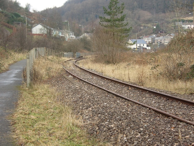
Image: © eswales Taken: Unknown
A bend on the Garw Valley Railway viewed from a path followed by Route 884 of the National Cycle Network. It is hoped that services can be resumed on the railway in the next decade (see http://garw-railway.co.uk/ ). The path followed by National Cycle Route 884 runs alongside the railway from a spot east of Bryngarw Country Park northwards to Pontycymer, where the line ends. The path continues north from there to Blaengarw.
Images are licensed for reuse under creativecommons.org/licenses/by-sa/2.0
Image Location
Latitude
51.592431
Longitude
-3.580815