Timbers Cottage at Cherry Gardens, Wethersfield
Introduction
The photograph on this page of Timbers Cottage at Cherry Gardens, Wethersfield by R Diane Drummond Sasiela as part of the Geograph project.
The Geograph project started in 2005 with the aim of publishing, organising and preserving representative images for every square kilometre of Great Britain, Ireland and the Isle of Man.

There are currently over 7.5m images from over 14,400 individuals and you can help contribute to the project by visiting https://www.geograph.org.uk
Timbers Cottage at Cherry Gardens, Wethersfield
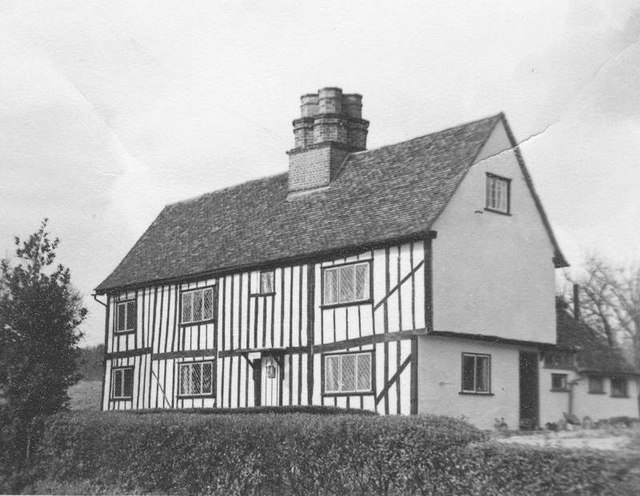
Image: © R Diane Drummond Sasiela Taken: Unknown
This tudor house was built in the 1600s. The picture was taken by my wife when she lived in the cottage in the mid 1950s. Located just over a mile south of Wethersfield on the B1053 road, on the way to Braintree.
Images are licensed for reuse under creativecommons.org/licenses/by-sa/2.0
Image Location
Latitude
51.941164
Longitude
0.502327