40%
Introduction
The photograph on this page of 40% by Ian Capper as part of the Geograph project.
The Geograph project started in 2005 with the aim of publishing, organising and preserving representative images for every square kilometre of Great Britain, Ireland and the Isle of Man.

There are currently over 7.5m images from over 14,400 individuals and you can help contribute to the project by visiting https://www.geograph.org.uk
40%
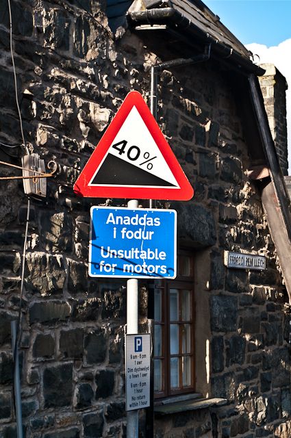
Image: © Ian Capper Taken: 17 Nov 2012
The "steep hill" sign at the top of Ffordd Pen Llech, the steepest tarmacked road in the UK (see Image for wider view). The sign shows 40% or 1 in 2.5, although apparently the steepest part is actually slightly shallower at 1 in 2.91. Whichever is the case, that is steep! It's not surprising that it is shown as unsuitable for motors (and probably not really suitable for anything else either). For a photo of the steepest point, see Image
Images are licensed for reuse under creativecommons.org/licenses/by-sa/2.0
Image Location
Latitude
52.859365
Longitude
-4.107803