Mortimer Road
Introduction
The photograph on this page of Mortimer Road by Ian Capper as part of the Geograph project.
The Geograph project started in 2005 with the aim of publishing, organising and preserving representative images for every square kilometre of Great Britain, Ireland and the Isle of Man.

There are currently over 7.5m images from over 14,400 individuals and you can help contribute to the project by visiting https://www.geograph.org.uk
Mortimer Road
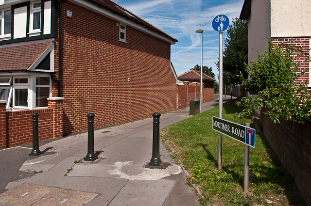
Image: © Ian Capper Taken: 17 Aug 2012
Mortimer Road was built in the 1970s or so to connect Lancing Road and Homefield Rise, replacing a house at this point in Lancing Road. At some point later it was blocked off (see Image), presumably because it was being used as a rat run to bypass the High Street. In 2010, it turned full circle, with a house built on the site (seen on the left of this photo). Despite its status at the Lancing Road end only as a footpath, it still retains its street sign, as seen here.
Images are licensed for reuse under creativecommons.org/licenses/by-sa/2.0
Image Location
Latitude
51.373923
Longitude
0.102195