Disused junction
Introduction
The photograph on this page of Disused junction by A-M-Jervis as part of the Geograph project.
The Geograph project started in 2005 with the aim of publishing, organising and preserving representative images for every square kilometre of Great Britain, Ireland and the Isle of Man.

There are currently over 7.5m images from over 14,400 individuals and you can help contribute to the project by visiting https://www.geograph.org.uk
Disused junction
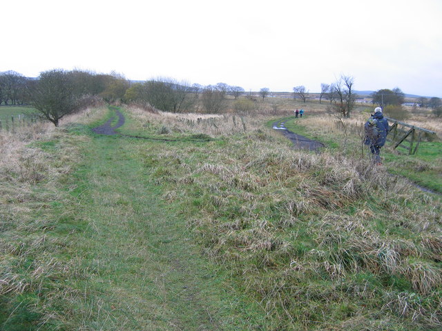
Image: © A-M-Jervis Taken: 12 Nov 2005
For a little under three years, from October 1965 till August 1968, this lonely spot on the moors north of Coalburn was a railway terminus. Passenger trains along the left-hand track, which belonged to British Railways, ceased in that first month (freight trains having ended the previous year) but coal trains continued to run round the curve to the right to Auchlochan Colliery until that closed in 1968. The wooden gate on the right originally closed across the branch, which was National Coal Board property. The more northerly houses of Coalburn can be seen in right distance.
Images are licensed for reuse under creativecommons.org/licenses/by-sa/2.0
Image Location
Latitude
55.599145
Longitude
-3.879211